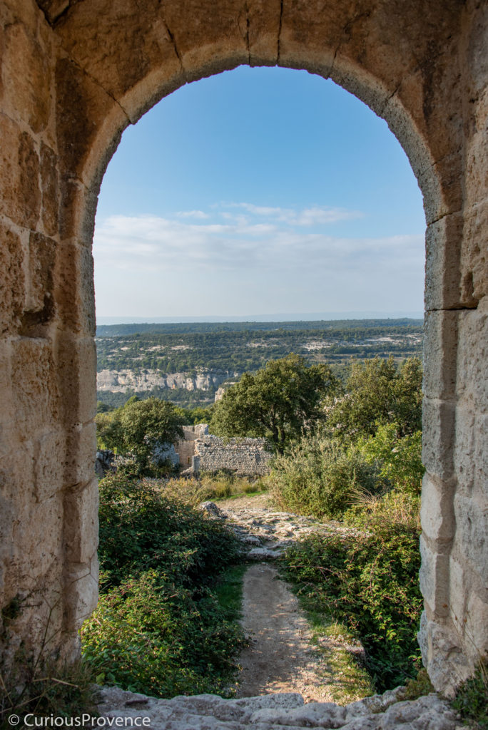
Evening at Fort Buoux.
Fort Buoux Ruins in the Luberon
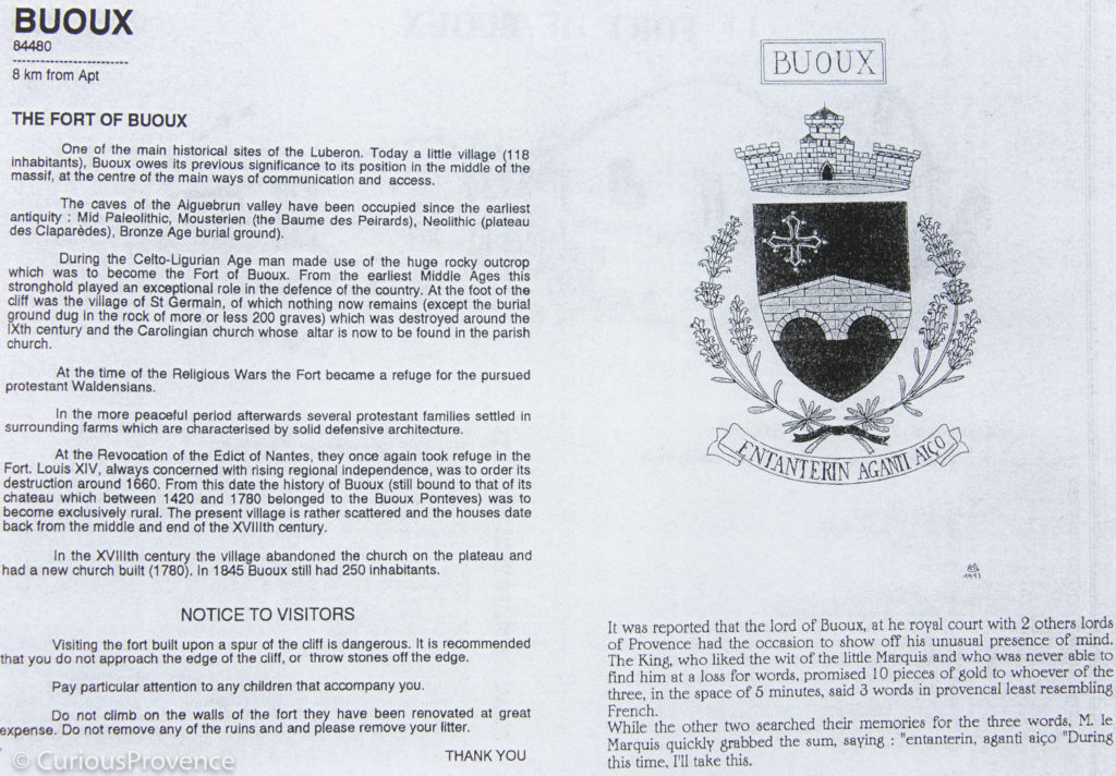
Fort Buoux, in the Luberon, is an ancient site that is definitely worth a visit. Close to Bonnieux and lesser known than some of the main attractions of the Luberon, you’ll find yourself on a winding road, at this time of year in the fog, that feels a little like the middle of nowhere. But this site was inhabited by pre-neathderthals, then Celtic peoples and the the persecuted Vaudois from Piemonte. The site hasn’t been inhabited for about 300 years. The layers of history are fascinating even though all you can see now are remnants.
Located in the Aiguebrun valley, the fortress remains were built in the early middle ages on top of a Ligurian-Celtic oppidum (fortified Iron Age settlement). You’ll find the ruins on top of a plateau high in the Luberon mountains about 10km south of Apt. Follow the signs for Fort Buoux that will take you to a parking lot, and from there it’s a 15 minute walk to the house where you can buy a ticket.
Luberon Baume
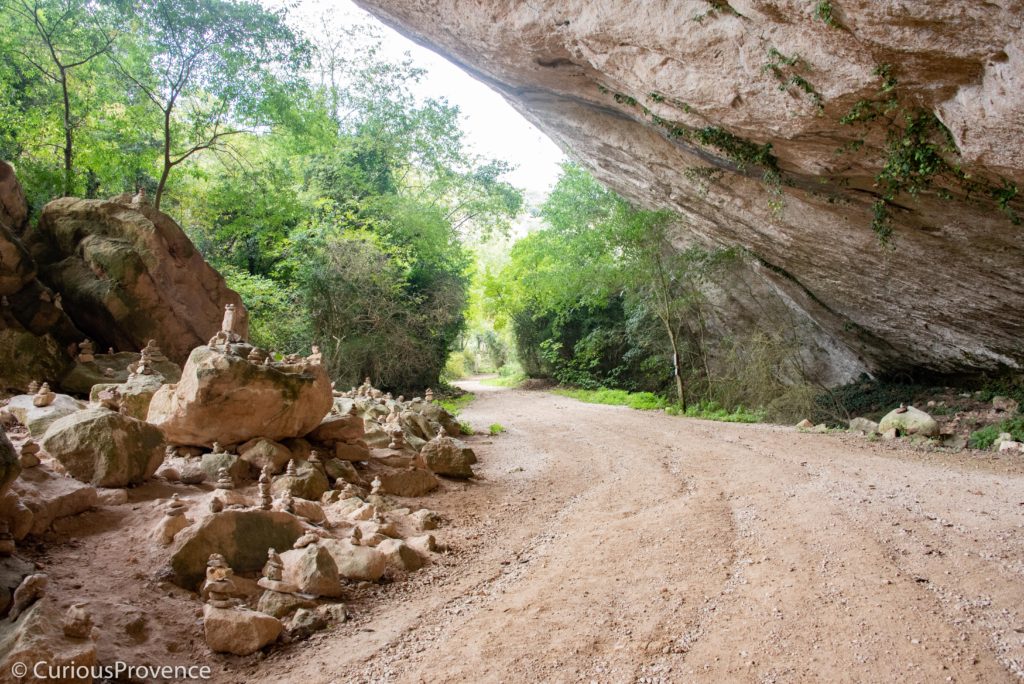
On the way to the ticket office you’ll pass the largest Baume (cliff overhang) in the Luberon left over from receding ice from the last ice age. It was here that Neanderthals in the region would seek shelter. Lithic stone stools have been found here.

There is evidence of holes made in the rock where logs used to be inserted to close the space around the overhang, or brume.

A common tomb here in front of cavernous spaces most likely used for habitation.
The boulders are the site of many stone sarcophagi, which you’ll find at many ancient sites in Provence. Eerily, each grave is a hollowed out crevice for a specific body. The graves are thought to date back to the 9th century. You’ll also find a couple graves around the cliff.

Stunning. There’s even a bit of moss! (sorry- kind of love moss- it’s the Brit in me)

The trail up to the tower of Fort Buoux.
Past the ticket office, keep climbing until you get to the the round tower that used to survey the valley. It dates back to the 16th century.

Absolutely love this tower.

The trail continues past inhabitations, silos dug into the rock, a 13th century church, the town ruins and more. Unfrotuantely, the few panels of information are in French. Perhaps a handy translation app can help you with this.
The Map


Prehistoric human habitat, used later for farm animals and now only for the occasional wild boar! (or so the sign says)

If you like painting or drawing, this would be a perfect place.

The archway leading into the ruins of Fort Buoux.
You’ll pass by more and more fortifications until you reach the donjon at the very top, from which the views out over the deep valleys are stunning. This was originally Gallon-Roman, but Celtic-Ligurian vestiges remain here as well.

Love it when walls built by humans blend into the natural landscape.

Fortifications.

Church archway.

Think I took about a hundred photos of this. So beautiful. Had it all to myself!

Houses under the fortress.

Watch your step! Grain silos dug into the rock. Why go through the effort? It’s thought it was the best way to keep animals out.

They’ve found no evidence of chimneys in this fort. Must have been absolutely freezing in the winter.

I felt so at peace wandering around here.

Inside the church. Architecture here from pre-Roman, Roman and 13th century.

Straight drop!

Two theories: this was either used to pour hot oil on assailants or, very different (or perhaps not?) it was a latrine for prisoners.
Be VERY careful. The sheer drop is impressive and frightening. If you have small children with you keep hold of them at all times. If you’re a real daredevil, see the secret staircase on the map. I didn’t even notice it while I was there (silly me) but I’ve heard stories that it’s terrifying.
Access
Opening Hours: 10h – 5pm
Closed on Tuesdays
The Fort is closed on all days where it rains, snows or there is strong winds.
In December and January it’s best to make a rendezvous to visit: 04.90.74.25.75
Adults: 5 euros
Kids under the age of 10 are free.
Cash or cheque only. No bank cards.
Les Vaudois in the Luberon

In blue: villages where Vaudois lived. In orange: villages ordered to be massacred by Francois 1, most horribly in Merindol, where 3000 people were murdered. Black: villages where there was no Vaudois presence. It’s fascinating to see that they lived right next to each other.
You’ll see many references especially on the maps close to the parking lot about the Vaudois, or Waldensians in English. These were a religious group that were pre-cursers by hundreds of years to Martin Luther’s reformation. Les Vaudois first appeared in Lyon around 1170 but became particularly popular in the Piemonte region of Italy.
Their beliefs differed from Roman Catholicism in many small ways but chiefly “the Waldensians held that temporal offices and dignities were not meant for preachers of the Gospel; that relics were simply bones that should not be regarded as special or holy; that pilgrimage served only to spend one’s money; that flesh might be eaten any day if one’s appetite served one; that holy water was not a whit more efficacious than rain water; and that prayer in a barn was just as effectual as if offered in a church.” This Christian group, embracing poverty, believed that with true belief the church should do the same. As you can imagine, it didn’t go over well.
Vaudois Persecutions
They were excommunicated and after a long history of being persecuted they eventually arrived in the Luberon to what were at the time villages in ruins such as Gordes and Roussillon. They were hard workers and respected by the local population. But when Martin Luther spoke out and the Vaudois then publicly associated themselves with the protestants, it was the perfect excuse to take their lands, and slaughter them. And that was before the wars of the religion. Interestingly, the Luberon was a Protestant stronghold in an otherwise Catholic France. The Vaudois suffered greatly but are remembered through their stone ruins such as these at Buoux.